Iran has announced new boundaries for the maritime area it claims is under the control of its armed forces in the Strait of Hormuz. The map, published by the Naval Command of the Islamic Revolutionary Guard Corps (IRGC), lays out southern and western limits in detail. The release coincides with the opening hours of the U.S. military's Project Freedom operation launched on May 4 with around 15,000 personnel.
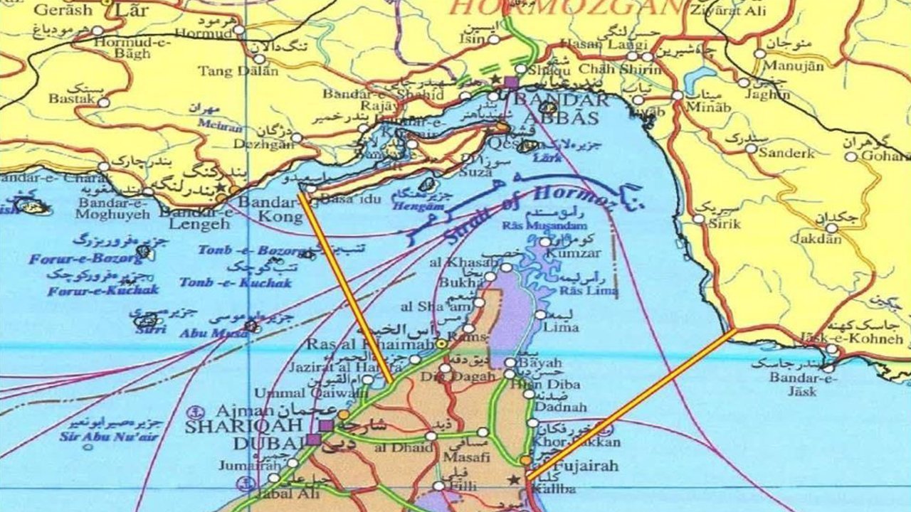
According to the map, the southern boundary runs from Mubarak Mountain in Iran to the southern edge of Fujairah in the United Arab Emirates. The western boundary stretches from the tip of Iran's Qeshm Island to Umm al Quwain in the UAE. The line effectively encloses the entire eastern entry of the strait within Iran's claimed control area and overlaps directly with the international transit corridor used by VLCCs, LR2 tankers and LNG carriers.
The map publication formalizes a Hormuz posture that has steadily hardened over the past 30 days. The Iranian Parliament issued a 12-point transit protocol via Bandar Abbas; foreign-ministry spokesman Esmaeil Baghaei confirmed the 14-point proposal sent to Washington through Pakistan; and parliamentary security commission chair Ebrahim Azizi framed any U.S. Hormuz intervention as a ceasefire violation. The new map provides an operational baseline for that political framing.
For supply-chain risk, the announced lines create a fresh reference for P&I insurance, charter-party war risk and BMP5/UKMTO advisories. With the boundary touching the southern approach to Fujairah and the strategic transit point at Qeshm Island, the practical capacity of out-of-Gulf evacuation routes becomes harder to defend. VLCC owners and LNG charterers are now treating the Cape of Good Hope alternative as a more realistic option than a week ago.
As the map was released, CENTCOM continued forward-deploying naval and air assets under Project Freedom; the announced control line gives the Iran-U.S. dispute a new legal and operational layer. Whether the fragile February 2026 ceasefire enters a fresh escalation cycle now hinges on how the United States and Gulf states reject — or contest — the boundaries declared on this map.
Key Takeaways:
1. Iran's IRGC Navy Command published a control-line map for the Strait of Hormuz.
2. Southern limit runs Mubarak Mountain–Fujairah; western limit runs Qeshm Island–Umm al Quwain.
3. The line covers the eastern entry of the strait and the VLCC/LR2/LNG transit corridor.
4. Release coincided with the opening hours of the U.S. Project Freedom operation (15,000 personnel).
5. Insurance and BMP5/UKMTO advisories now have a new reference frame for war-risk pricing.